Recommended Read: How To Measure Distance On Google Earth
Find Coordinates Of A Location
There are several ways to find out the longitude and latitude of a location. However, you can use any one of the following methods for the same.
1 Find Coordinates Of A Location1.1 Using Google Earth1.2 Get Coordinates Using Google Maps1.3 Find Location Coordinates Using Wikipedia2 Enter Coordinates Into Google Earth2.1 Entering Coordinates In The DMS Format2.2 Geographical Coordinates In DMM Format2.3 Using DD coordinates In Google Earth2.4 Final Thoughts
Using Google Earth
For this, you can either use the Google Earth Pro software or Google Earth online on the Chrome browser.
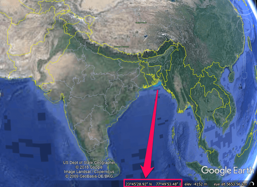
Open Google Earth on your computer. Now move your mouse cursor over the map and you will see the respective coordinates at the bottom right corner.
In case your cursor is out of the map then the coordinates of the center of the map appear at the bottom. Note: You cannot find the longitude and latitudes of a location on the Google Earth mobile app.
Get Coordinates Using Google Maps
Open Google Maps on your computer and now visit a place of your choice. Now right click on the place name and from the options select What’s here?
Next, you will see the coordinates of that location at the bottom of the screen in the DD format
Find Location Coordinates Using Wikipedia
Other than using Google Earth and Google Maps you can use Wikipedia to find out the location coordinates of some famous places and cities around the world.
Open Wikipedia on your browser and search for the place in the search bar.
Now as the page loads you will probably see the coordinates of that place on the right panel under location details.
Now since you know the coordinates of the location let’s try to manually enter them in Google Earth.
Enter Coordinates Into Google Earth
As we told you earlier there are three GPS coordinate formats supported by Google Earth and here’s how you can use them to pinpoint a location on it.
Entering Coordinates In The DMS Format
DMS stands for Degrees, Minutes, and Seconds. In a DMS notation, the first number in the coordinate is followed by a degree symbol, while the second number by an apostrophe which represents the minutes. And the quotation mark after the third number is a symbol of seconds. At last, the N(North), S(South), E(East), and W(West) represents the directions. For example, 48°51’30.13″ N, 2°17’40.13″ E is the DMS coordinates of the Eiffel Tower. Now when you enter this location coordinates in the search bar and click Search or press Enter then you can see that the pin points at the Eiffel Tower on the map.
Geographical Coordinates In DMM Format
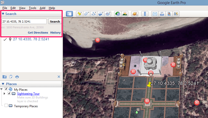
The DMM (Degree Decimal Minutes) is somewhat similar to the DMS format but here the seconds are represented as a decimal part of the minute. Also, the direction here is not shown by N, S, E, and W instead of that North and East are shown as a positive value, on the other hand, South and West as negative. The DMM coordinates of the Taj Mahal can be written as 27 10.4335, 78 2.5241.
Using DD coordinates In Google Earth
The DD or Decimal Degree format is the easiest form of writing the coordinates and is an alternative to the DMS and DMM format. In the DD format, the minutes and seconds are represented by a decimal unit of degree. For example, Opera House coordinates in DD format are written as -33.856464, 151.215865.
You can similarly put the coordinates in the Google Earth mobile app to point out the location on the map. Recommended Read: How To Fly A Plane On Google Earth
Final Thoughts
The knowledge of coordinates can help you find and pinpoint the exact location on Google Earth. However, remembering the longitude and latitude values is not that easy. But you can easily find coordinates using the methods we showed you and use them in Google Earth. Save my name, email, and website in this browser for the next time I comment. Notify me of follow-up comments via e-mail.
Δ


